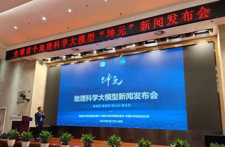
Beijing: China has unveiled the world’s first multi-modal large language model (LLM) specifically tailored for advancement in geographic sciences. This innovative model combines various data types, including text, images, and geographical information, to enhance analysis and understanding of complex geographic phenomena.
The model, named Sigma Geography, was developed by a team of researchers from the Institute of Geographic Sciences and Natural Resources Research (IGSNRR), the Institute of Tibetan Plateau Research and the Institute of Automation, all under the Chinese Academy of Sciences, and other organisations.
The multi-modal LLM is designed to support researchers, policymakers, and professionals across a range of applications, such as urban planning, environmental monitoring, and disaster management. By integrating diverse data formats, the model can generate insights that are more comprehensive and contextually relevant.

Sigma Geography is capable of addressing professional geographical inquiries, analysing geographical articles, and conducting detailed queries and analyses of geographical data, as well as creating thematic maps, according to Su Fenzhen, Deputy Director of IGSNRR.
Unlike general large language models (LLMs), Sigma Geography possesses a more nuanced understanding of language patterns, specialized terminology, and professional knowledge in geography, allowing it to effectively tackle specialized topics.
In addition, Sigma Geography can pair its generated text responses with landscape photos, thematic maps, or schematic charts, enhancing users’ comprehension through visual representation. It can also perform tasks such as concept understanding, data collection, information analysis, and mapping based on user instructions, ultimately producing the professional geographic charts that users require.
The launch of this multi-modal LLM positions China at the forefront of technological innovation in geographic sciences, enhancing its ability to conduct high-level research and develop effective policies.
As the model continues to evolve, it holds the potential to drive significant advancements in geographic research and practical applications, fostering a more informed and responsive approach to the challenges faced in our rapidly changing world.


