


Hong Kong: Hong Kong raised its highest storm warning as Typhoon Wipha lashed the city with fierce winds exceeding 167 kilometres (103 miles) per hour, bringing torrential rain and dangerous gusts that disrupted air, sea, and land transport across the territory.
At 9:20 am local time (0120 GMT), the Hong Kong Observatory hoisted the No. 10 typhoon signal, the most severe in the city’s warning system, stating it would remain in place ‘for some time.’
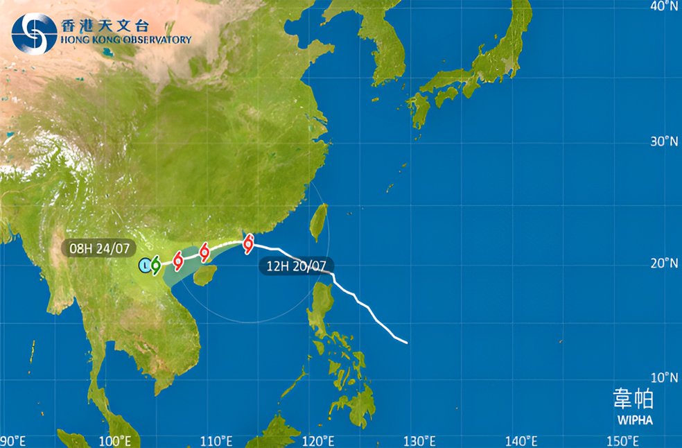
The observatory forecast that Typhoon Wipha would pass roughly 50 kilometres to the south of its headquarters, with hurricane-force winds already impacting southern parts of Hong Kong.
Cathay Pacific Airways cancelled all of its inbound and outbound flights at Hong Kong International Airport between 5 am and 6 pm on July 20. The airline also waived ticket change fees and made arrangements for passengers to rebook their travel.
Public transportation across the city came to a near standstill. Most public transport services were suspended, including ferries, due to hazardous sea swells and high wind conditions.
So far, Wipha has led to one reported injury involving a man, along with 15 reports of uprooted trees. In total, 214 people have taken shelter in government-run temporary refuge centres.
The last time Hong Kong issued the No. 10 signal was during Super Typhoon Saola in 2023, which caused widespread damage including 86 injuries, multiple landslides, and the toppling of thousands of trees.
The current Typhoon Wipha warning has prompted emergency authorities to remain on high alert, urging the public to stay indoors, keep away from coastal areas, and avoid unnecessary travel. With hurricane-force winds, intense rainfall, and storm surges continuing to affect the city, residents have been advised to exercise extreme caution.
ALSO READ | Jeffrey Epstein Case: Trump demands full disclosure of files